 Active
1 / 10


 Listing courtesy of Oregon Life Homes, 541-391-4945
1235 LOCUST ST
Oakland, OR 97462 · Douglas County
RMLS # 417033505
What's special
Single level
Picked out from the listing description. Always confirm with us.
About this home
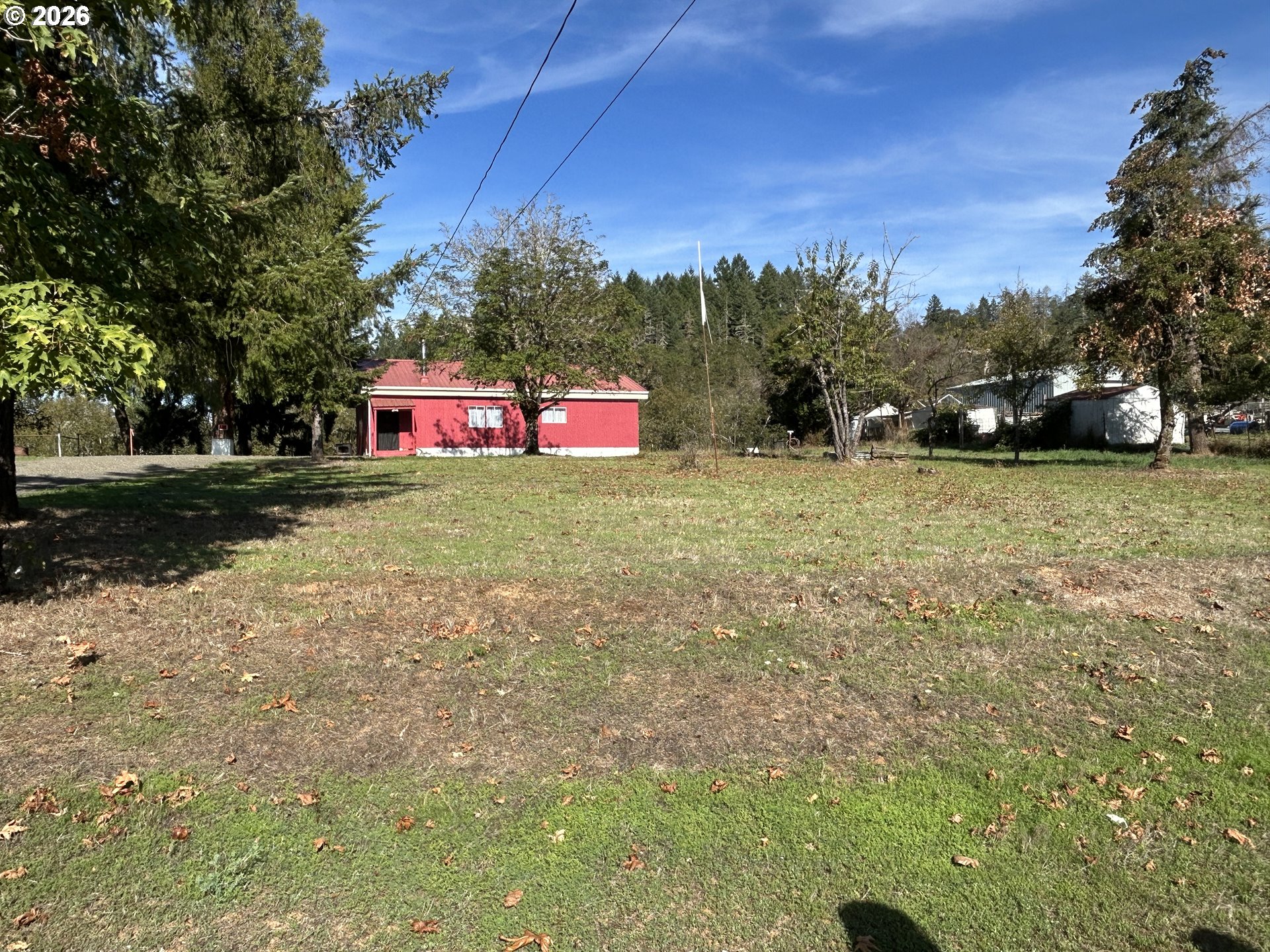
Located in lovely downtown Oakland, this lot provides the perfect spot to build, already equipped with power & sewer. Cash only, as-is - existing structure is of no value. Buyer to do own due diligence regarding all aspects of this property.
Property Details
Rooms
Bathrooms
- Main level
- 1 full
Systems and floor area
- Total sq ft
- 1,057
- Main level sq ft
- 1,057
- Area source
- County
- Style
- 1 Story
- Year built
- 1945
- Condition
- Fixer
- New construction
- No
- Basement
- None
- Heating
- None
- Fuel
- Electricity
- Exterior
- Wood Siding
- View
- No
- Lot size (acres)
- 0.34
- Lot size (sq ft)
- 14,810
- Lot size range
- 10,000 to 14,999 SqFt
- Attached garage
- No
- Parking
- Driveway,RV Access/Parking
- Water
- Public Water
- Sewer
- Public Sewer
- Road surface
- Paved
- County
- Douglas
- MLS area
- 256 - Douglas Co: Sutherlin/north of Roseburg
- Elementary school
- Oakland
- Middle school
- Lincoln
- High school
- Oakland
- Senior community
- No
- Directions
- I-5 Exit 138, R on Stearns,L on Front St, R on Locust to address on left.
- Annual property taxes
- $1,615
- Tax year
- 2025
- Tax ID
- R18784
- Listing terms
- Cash
- HOA
- No
- Home warranty
- No
- Disclosures
- Disclosure
- Bank owned
- No
- Short sale
- No
- Third party approval
- No
- Land lease
- No
- Type
- Residential
- Subtype
- Single Family Residence
- ADU
- No
- Listed on
- Nov 2, 2026
- Days on market
- 16
RMLS # 417033505 · Status: Active
Location
1235 LOCUST ST, Oakland, OR 97462 · Douglas County
Drag to move around. Use + and − to zoom. Open in Google Maps ↗
Nearby Schools
Assigned schools as listed by the seller's agent. Confirm school boundaries with the school district.
Flood and Hazard Risk
Flood zone from FEMA's National Flood Hazard Layer for this location. Hazard ratings are for the surrounding census tract from the FEMA National Risk Index. View the FEMA flood map ›
Price and Tax History
Price history
Property taxes